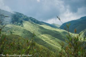
Meghalaya is probably the most touristy of the states in the Northeast, and it has been so for a long time. When the British explorers first reached these hills of present day Meghalaya, they were taken aback by the similarities they had with Scottish Highlands. They decided to built a capital in Shillong for the entire Northeastern region and often referred to it as the Scotland of the East.
After independence, they remained a part of Assam and Shillong kept serving as the capital of Assam. It was declared a separate state in 1972 and it was given a new name Meghalaya (Abode of Clouds), considering the fact that it is one of the rainiest regions on earth and these hills are covered with clouds more often than not.
Meghalaya Tourism offers an exiting combination of both popular as well as offbeat attractions. Some of its hill stations and waterfalls have been popular for almost a century now. Some others have come up in the last few years. More and more new attractions keep getting discovered and added to the list and this is the beauty of Meghalaya in particular and the Northeast in general. Meghalaya offers something for everyone and nobody comes back empty handed.
Understanding Meghalaya
The Meghalaya state at present consists of three hill ranges, Khasi Hills, Jaintia Hills, and Garo Hills, named after the predominant ethnic groups staying in these areas, namely the Khasis, the Jaintias, and the Garos.
The Khasi Hills
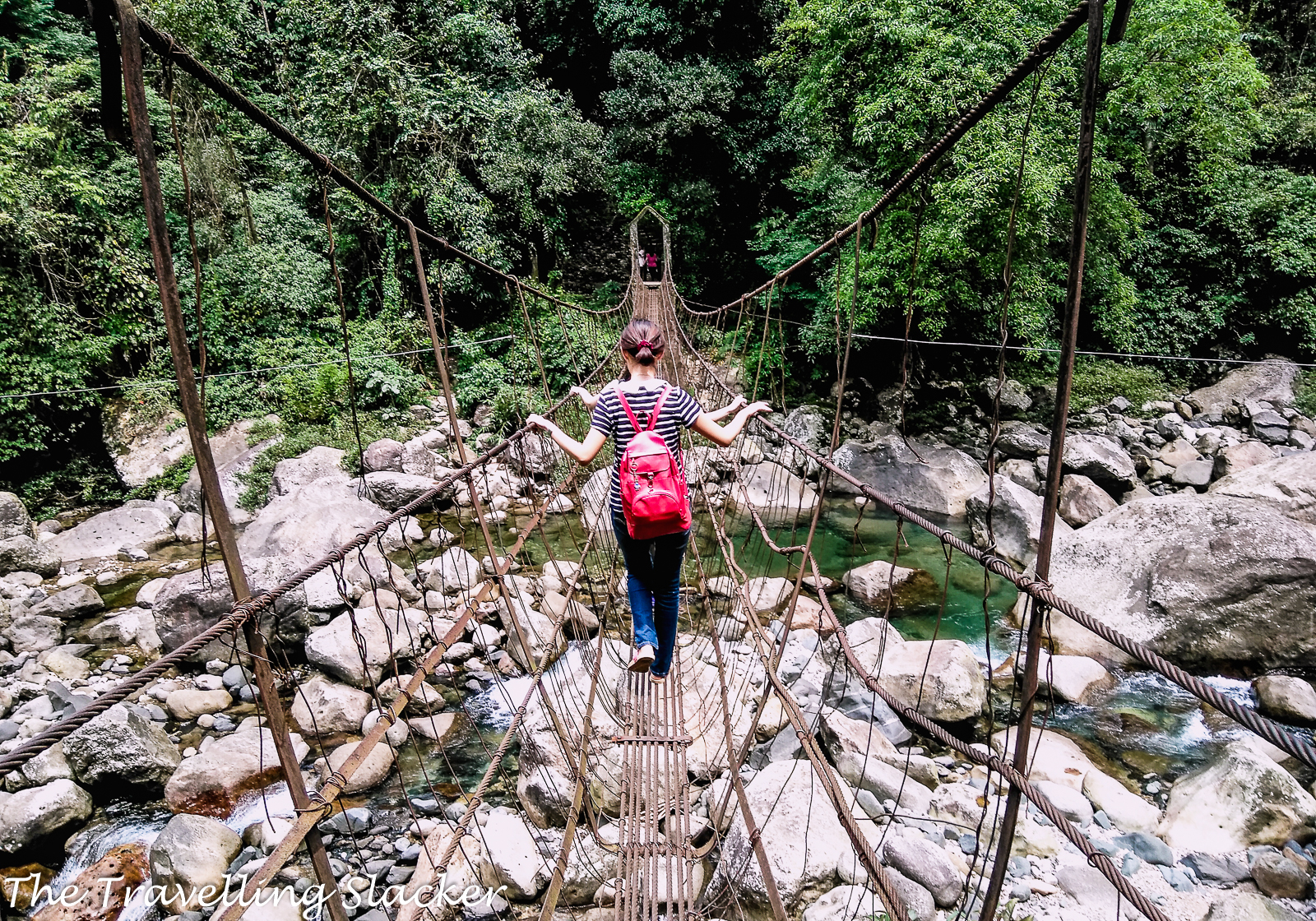
The Khasi Hills are centered around the capital Shillong and it is the most developed and easily accessible area of the lot with Shillong being a mere 2 hour drive through the highway from Guwahati. On the other hand, the Cherrapunji belt receives the highest rainfall in the world but is not its only claim to fame. Numerous living root bridges, picturesque waterfalls, and natural caves makes this region a treasure trove for thrill-seekers. Mawsynnram, the current wettest place in the world, is not far away from here, and nor is Nongriat, the home of the famed double-decker living root bridge. Mawlynnong, the village that achieved fame through its cleanliness and discipline, and the transparent river of Dawki, can also be reached with a short detour. Some areas of West Khasi Hills are lesser-known but getting developed now such as Nongkhnum Island
The Jaintia Hills
The Jaintia Hills are comparatively lesser known but they have up and coming destinations such as the Krang Suri, one of the most beautiful waterfall you will ever see, and Nartiang Monoliths, some primordial, menhir-like installations by the ancestors. The famour crystal clear waters of Dawki is located on the border of Khasi & Jaintia Hills.
The Garo Hills
On the other hand, the Garo Hills remain the remotest and least explored area, centred around the town of Tura. It also has its own hidden and mysterious gems like Nokrek and Balpakram, that deserve much more attention than they are receiving now.
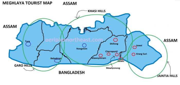
Meghalaya Tourism Map
Lets have a look at the map of Meghalaya from a tourism perspective. The big green circles are roughly indicating the areas covered by Khasi, Jainti, & Garo Hills. The small red circles indicate popular tourist areas while the small blue circles indicate lesser-known but potential tourist areas.
Shillong
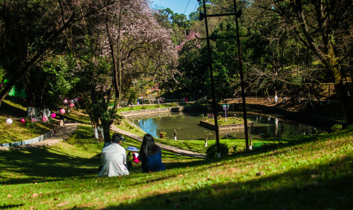
Shillong needs no introduction. The capital of the state is also the capital of Meghalaya Tourism. It is a picturesque and romantic hill station, a major draw for tourists. Perched at 1450 meters above sea level, this lovely hill station is surrounded by beauty on all sides – pine covered hills, flowing streams and waterfalls which give it a milder climate than tropical India. While the city has grown fast in recent times, the colonial charm of the British era buildings and churches set amidst pine forests is unmistakeable.
Cherrapunjee
Cherrapunjee was once known as the wetters place on earth. The record keeps shifting but nevertheless, it has much more to offer. Numerous equisite waterfalls dot the region while the iconic trek to the double-decker root bridge of Nongriat also starts from here. The area is also known for some of the longest caves in India.
Mawsynnram
Mawsynnram is another claimant for the wettest place on earth. It is not far from Cherrapunjee and is also famous for several major caves.
Mawlynnong
Mawlynnong village became famous for its cleanliness and traditional ecofriendly village management among the Khasis. The nearby village of Riwai has a living root bridge. .
Dawki
Dawki and nearby Shnopdeng villages are famous for the crystal clear Umgot River, which is one of the cleanest and most beautiful river you will ever see in your life. You can swim or take boat rides in that transparent river. It is actually located on the southern tip of the hills, bordering Bangladesh.
Krang Suri
Krang Suri is arguably one of the most beautiful waterfalls anyone has ever seen. Any attempt to describe it in words is futile. One must see it to believe it. It is located around 32 KMs away from Jowai, near a small settlement called Amlarem.
Jowai
Jowai is the most important town in the Jaintia Hills. The Jaintia People are one of the most ancient inhabitants of these hills with a rich history and culture. They inhabit the eastern areas of of Meghalaya, known as Jaintia Hills. It has a few hotels and homestays and can be used as a base to explore teh rest of the region.
Nongstoin
Nongstoin is the headquarters of West Khasi Hills. It is lesser known but is begining to imporve its tourism. Nongkhnum River Island and Beach is something in this region that has gradually grown popular. .
Tura
Tura is actually much closer to Bangladesh border. The towns of western Assam are also reachable from here. Tura has been an important town of this desolated region for a long time and it is a reasonably big town now with regular bus connectivity from Guwahati and helicopter services connected to Shillong.
Balpakram
Balpakram literally means “land of perpetual winds”. Locals believe that it is where the spirits of their ancestors live. It is located on a steep cliff overlooking the border of Bangladesh, that is often compared Canyon. It is so remote that it is still 155 KMs away from Tura, which makes it the holy grail for genuine explorers. The major mammals that have been reported here include red panda, wild water buffalo, golden cat, leopard, marbled cat, elephant, stump-tailed macaque, Pig-tailed macaque, tiger, slow loris, clouded leopard, pangolin, flying squirrel, hoolock gibbon and many more.